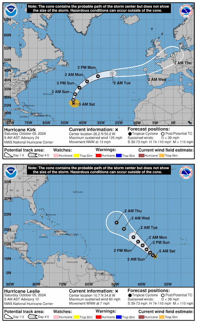
See Kirk and Leslie below
Disturbance 1. Gulf of Mexico (AL92): A broad area of low pressure is located over the southwestern Gulf of Mexico and is gradually becoming better organized. Development of this system is expected, and a tropical depression or storm is likely to form later today or on Sunday while it moves slowly eastward over the southwestern Gulf of Mexico. By early next week, the system is forecast to move faster eastward or northeastward across the central and eastern Gulf of Mexico where additional strengthening is likely. Formation chance through 48 hours...high...70 percent and formation chance through 7 days...high...90 percent.
Disturbance 2. Hurricane Kirk is no threat to our area and is way out there in the Atlantic and moving NNW at 13 MPH toward Europe. A turn to the north is expected today, followed by a faster northeastward motion on Sunday and Monday. Kirk remains a powerful storm with 125 MPH maximum sustained winds. There are no coastal watches or warnings in effect.
Disturbance 3. Hurricane Leslie is not likely a threat to our as it moves WNW across the eastern Atlantic. A gradual weakening trend is forecast to begin on Sunday. There are no coastal watches or warnings in effect.
Disturbance 4. Far Eastern Tropical Atlantic: A tropical wave is expected to move off the west coast of Africa on Monday or Tuesday. Some development of this system is possible thereafter while it moves westward or west-northwestward across the eastern tropical Atlantic. The system is expected to move near or over the Cabo Verde Islands on Wednesday and Thursday. Formation chance through 48 hours...low...near 0 percent and formation chance through 7 days...low...30 percent.


No comments:
Post a Comment