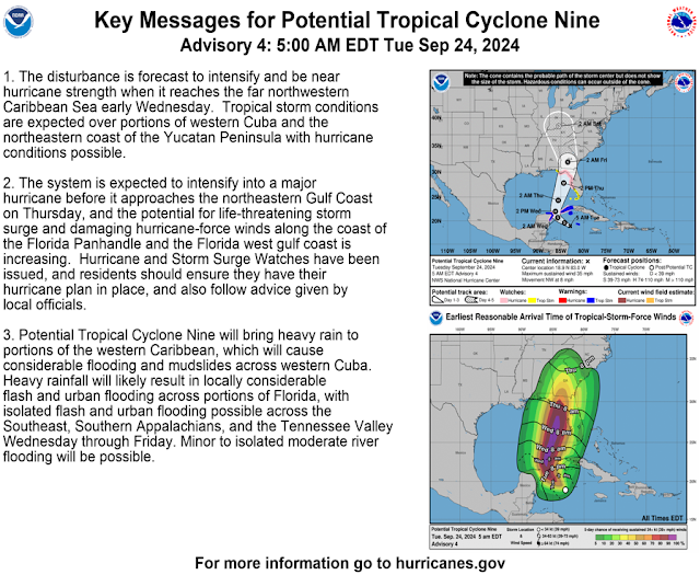
Disturbance 1. Potential Tropical Cyclone Nine is moving toward the northwest near 9 mph with maximum sustained winds near 35 mph. This general motion is expected later today and tonight, followed by a faster northward to north-northeastward motion on Wednesday and Thursday. Strengthening is expected during the next few days, and the system is forecast to become a hurricane on Wednesday and continue strengthening on Thursday as it moves across the eastern Gulf of Mexico.
Confidence continues to increase that direct impacts will be to the east of our area.
Disturbance 2. Eastern and Central Tropical Atlantic: Shower and thunderstorm activity continues to show signs of organization in association with a tropical wave located near the Cabo Verde Islands. Environmental conditions appear favorable for gradual development of this system, and a tropical depression is likely to form in a few days while it moves westward to west-northwestward across the eastern and central tropical Atlantic. Formation chance through 48 hours...medium...40 percent and formation chance through 7 days...high...80 percent.


No comments:
Post a Comment